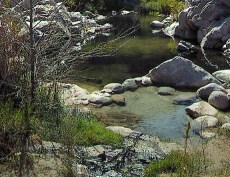
Ibcalrr, That spot you said as " out there all by itself " which is the one below the spillway has seen vandalism, many times. My truck was vandalised once there. Another time I parked down by the big pool where the pipe that runs through the dam empties the stream water out and was also vanalised another time there. People at times hike from the pullout on Arrowhead Lake road, at the opposite side of the two dams from the spillway and have been vandalised there. The spot where you parked your car may be a bit safer but I wouldn't trust leaving my car there overnight either.
The PCT portion that you hiked from your car which follows the West Fork of the Mojave River downstream ( on its east side ) heads to the dam area, then continues on past the dam intake, remaining on the same side, then when you reach where the canyon makes a sharp right hand turn away from the edge of the dam, the PCT still stays on the same side around the corner but is set back from the creek a bit. It continues up the canyon a ways then ( if I remember it correctly ) you cross the creek pretty quickly and head up a 45 degree incline portion that heads up to the old aqueduct trail above the creek on the north side, the one you hiked to the arch bridge. I have not been that way in a long time so it may not be very visible for lack of use.
If there is rain conditions but not snow up in the Arrowhead area you could use the alternative route of accessing the Bradford Ridge trail head off of HWY 173, getting to it by passing over the mountains from the San Bernardino side. It has the advantage of your being able to drive right to the trail head on pavement, and the trail is roughly two and a half miles long. Also you do not have to wade any creeks hiking that trail, even if there are heavy rains. If there is snow down low you most likely would never make it that way since I don't think they grade the road out that far to the trail head area.
Best bet since I imagine you would rather spend more time at the springs, use the Bowen Ranch Rd when the weather conditions are conducive to access by your given vehicle.
A number I have for Brad Burns is 909-382-2767, or you might try Andrew Price 909-382-2737
Re: Trip report 4/14
All posts are those of the individual authors and the owner
of this site does not endorse them. Content should be considered opinion
and not fact until verified independently.
| Subject | Author | Views | Posted |
|---|---|---|---|
| lbcalrr | 2573 | April 16, 2012 03:16AM | |
| neogeo | 1298 | April 16, 2012 09:51AM | |
| DLM | 1117 | April 16, 2012 10:21AM | |
| coyote | 1001 | April 16, 2012 03:09PM | |
| Paul P. | 1031 | April 16, 2012 03:49PM | |
| lbcalrr | 947 | April 16, 2012 06:50PM | |
| neogeo | 932 | April 16, 2012 09:30PM | |
| outlaw1 | 1003 | April 16, 2012 09:50PM | |
| Wizard | 966 | April 16, 2012 11:36PM | |
| lbcalrr | 1055 | April 17, 2012 02:45AM | |
| mdskibum | 1083 | April 17, 2012 09:17AM | |
| Wizard | 1230 | April 17, 2012 12:07PM | |
| hiker | 920 | April 17, 2012 09:45PM | |
| mdskibum | 903 | April 18, 2012 08:22AM | |
| Wizard | 1042 | April 18, 2012 09:06PM | |
| Wizard | 1513 | April 18, 2012 09:08PM | |
| Paul P. | 814 | April 17, 2012 09:47AM |
Sorry, only registered users may post in this forum.


