All posts are those of the individual authors and the owner of this site does not endorse them. Content should be considered
opinion
and not fact until verified independently.
Previous Message
Next Message
Forum List
Message List
New Topic
Print View
JoelTDahl
April 07, 2011 04:37PM
Registered: 14 years ago
Posts: 78
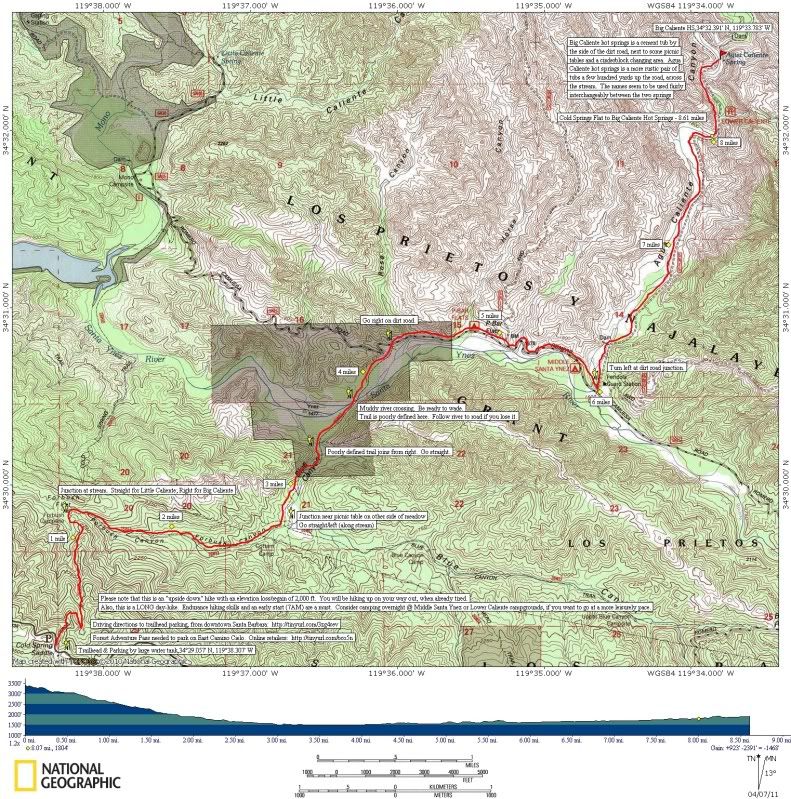
Click here for full-size image on Picassa.
Click here for segment # 1 of full-size map on Picassa, cropped to print to a "landscape" 8.5X11 sheet of printer paper.
Click here for segment # 2 of full size map on Picassa, cropped to print to a "landscape" 8.5X11 sheet of printer paper.
Link to googlemaps driving directions from downtown Santa Barbara to the trailhead parking.
For directions from anywhere else, click on the link, replace "Santa Barbara, CA" with the address of your new origination point, and click "get directions."
Link to online list of vendors where you can purchase a Forest Adventure Pass
(needed for parking at the trailhead).
Reply
Quote
RSS
Subject
Author
Views
Posted
Hiker's topo map from East Camino Cielo road to Big Caliente Hot Springs (also known as Agua Caliente Hot Springs)
JoelTDahl
6835
April 07, 2011 04:37PM
Re: Hiker's topo map from East Camino Cielo road to Big Caliente Hot Springs (also known as Agua Caliente Hot Springs)
Madrox
1728
April 12, 2011 10:22PM
Sorry, only registered users may post in this forum.
Click here to login