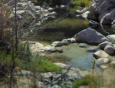
Great report. That is why Jobe hikes now rather than bikes, it takes legs to get back up the Bradford trail. There is currently only one easy hike, that is from Bowen and it is a cold crossing. The 173 and PCT crossing is 6.7 miles and you still have to cross at the dam. You could go to Splinter behind Cedar Glen.(Jobe and I may disagree where it originally is but currently the Forest Service call it near the PCT bridge). That is a long hike. At least 8.3 miles from the steel bridge on the PCT. You can also come down from 173 on the Bradford Trail. I trust you have legs to return to your car. When the creek is running like a river then the Bradford is the ONLY way to get to the springs and some of the pools, even all on a real rampage, can be under water. See Wizard's photos if you want to see the nature of this canyon.
I suggest before you go to DCHS that you understand this is a wilderness and you are mostly on your own. Most (99 per cent of the time) it is able to accommodate the people who bring no water and have no thought for its real nature. But that small percentage of the time it can be a real issue. I've seen it running 30-45 MPH on a flood day with the big rock in the middle of the creek under 3 feet of torrent. Wizard knows what I'm telling you.
My packing list is bring enough water in for a couple of extra people. There are always people who are out going out!
Keep some sunscreen on for the 10-12 UV rating of the summer. You need it even under your clothes. If you don't wear any put more on!
Re: hot springs trip report Easter Sunday
All posts are those of the individual authors and the owner
of this site does not endorse them. Content should be considered opinion
and not fact until verified independently.
| Subject | Author | Views | Posted |
|---|---|---|---|
| paul-v | 2363 | April 05, 2010 09:30AM | |
| Madrox | 1136 | April 05, 2010 04:02PM | |
| kingnate2000 | 1207 | April 05, 2010 04:32PM | |
| jobe | 1204 | April 05, 2010 11:06PM | |
| coyote | 2773 | April 09, 2010 11:56PM |
Sorry, only registered users may post in this forum.


