tate of California • Department of Transportation
NEWS RELEASE
Date: Monday, May 18, 2009
District 7: Los Angeles & Ventura Counties
Contact: Maria Raptis
Phone: (213) 897-9372
FOR IMMEDIATE RELEASE
MEDIA ADVISORY
ANGELES CREST HIGHWAY --A SCENIC WAY TO TRAVEL
Closed since 2004 for repairs, a portion of State Route 2 opens to the public
WHO: The California Department of Transportation (Caltrans)
Confirmed speakers: Doug Failing, Caltrans District 7 Director (Los Angeles and Ventura Counties) and Brad Mitzelfelt, Supervisor, District 1, San Bernardino County Board of Supervisors; and Captain Gregory Peck, California Highway Patrol, Southern Division.
WHAT: Opening Event for the Angeles Crest Highway (State Route 2), near Wrightwood.
WHEN: Wednesday, May 20, 2009 at 9:30 a.m.
WHERE: Angeles Crest Highway (SR-2) at Vincent Gap Vista Point, in the Angeles National Forest, approximately 12 miles west of Wrightwood, CA. Please plan for 1-1/2 hours to 2 hours for travel time in each direction. Parking lot available directly across from event site.
BACKGROUND: This $10.5 million project on SR-2 constructed a bridge approximately 10 miles west of Wrightwood, as well as roadway repairs, and safety improvements. Severe winter weather conditions in 2004/05 caused extensive damage at 17 sites along a 10-mile section of this route. Additional damage occurred in spring, 2006 required the construction of a bridge designed to allow rocks and run-off water to flow beneath it. This scenic route provides a direct connection to and from Los Angeles and San Bernardino Counties for motorists, sports enthusiasts and emergency responders.
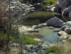
PHOTO OP: Ribbon-cutting site overlooks a breathtaking view of the Forest.
DIRECTIONS: From Los Angeles County:
· Northbound Angeles Crest Highway (SR-2) to Vincent Gap Vista Point.
· Eastbound San Bernardino Freeway (I-10) or eastbound Foothill Freeway (I-210) to northbound Ontario Freeway (I-15) to westbound Pearblossom Highway (SR-138) to southbound Angeles Crest Highway (SR-2). Arrive at Vincent Gap Vista Point.
From Santa Clarita or San Fernando Valley:
· Northbound Antelope Valley Freeway (SR-14) to eastbound Pearblossom Highway (County road). Continue on eastbound Pearblossom Highway (SR-138) to southbound Angeles Crest Highway (SR-2). Arrive at Vincent Gap Vista Point.
From San Bernardino County:
· Northbound Mojave Freeway (I-15) to westbound State Route 138 west to southbound Angeles Crest Highway (SR-2). Arrive at Vincent Gap Vista Point.
Re: Angeles Crest Highway
All posts are those of the individual authors and the owner
of this site does not endorse them. Content should be considered opinion
and not fact until verified independently.
| Subject | Author | Views | Posted |
|---|---|---|---|
| Rick | 1979 | April 25, 2009 10:04PM | |
| Rick | 3574 | May 20, 2009 05:34PM |
Sorry, only registered users may post in this forum.


