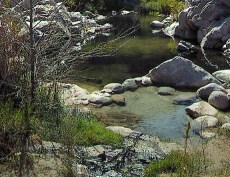
Going west from the Rainbow bridge you will notice how level the trail is going down the canyon all the way to the dam, and that is because you are walking along the route, and at times even in the aquaduct. You will see walls along the way, and even spots where they built covered sections that have holes in them in spots, tube like structure since down closer to the dam the aqueduct runs across steep hillsides with cliffs. From above the spillway at the Mohave Forks dam where the PCT switchbacks down the hill and then into the canyon heading south, that aqueduct up on the hill actually continues on west and northwest around the corner to its western most end where you will see a very big rusty pipe heading steeply down the hill and at the bottom of the hill you can see signs of where it used to be heading off towards Hesperia. There is another long section of rusty pipe exposed a little ways from where the other goes up the steep hill.
I'm sure it was a major problem trying to keep the system intact, especially when there were big rainstorms with lots of debris and rocks cascading down the hills. As time went by other types of ways to access water came along like wells to get ground water. I do not know when the aqueduct was built, if there was a name for it, or how long it was in operation. I have looked online before to try and find some historical information about it but can not find any yet. I had thought before of calling the Victor Valley Museum to see if they might know about it or could tell me where to find info on this old aqueduct.
Thanks for the trip report Paulespo and also for the big photos you took. These moderate type floods tend to usually strip sand away from areas around the Phoenix Pool where back in 2010/2011 the two very high water flooding events deposited a huge amount of new sand. That big heavy iron no camping sign actually fell over in those floods and disappeared under the sand. I tried to compare older pictures to try and locate where it was but could not find it. Then one day our DCV Group was down for the day and we were having lunch on the sand and one of my daughters noticed something poking her under the sand and it was an edge of the sign. Then a group of us dug and dug and finally with much help from Jobes strong back we tipped it up straight. To give you an idea of how much sand at that sign has since been eroded away, that big blob of cement at the bottom of the sign has a wide flat section at the top, and the beach level was even with that flat area. Now look at it! That little Woodsey Owl sign was set in some boulders and further up the beach so it never fell over. Many years ago that little sign was made of some type of plastic, and it was cracked, fading and falling apart so I removed it and took it to a friend who had a sign company, and he copied the sign, making it out of much stronger material. That Woodsey Owl is a USFS symbol from long ago which I don't think is even any longer used by the USFS. Its held up very well except for what looks like someone had thrown a rock at it, and some other scratch on it. Woodsey Owl lives on at DCHS

Edited 1 time(s). Last edit at 02/12/2019 09:05PM by Wizard.


