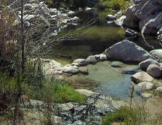
I hiked to DCHS yesterday while it was raining hard, and after I was there for a couple of hours it finally let up. The creek when I arrived was up a bit, maybe 3 inches but was still near summer time levels. I soaked in the AZ/Phoenix Pool, the one furthest upstream close to the stream. Near the end of my soak I heard the rapids just upstream getting louder and knew there was a surge of water beginning from the rains earlier in the day. Depending on how much and where it rains the increased water flow in the creek can take a while to work its way downstream. I soaked a little longer and watched the water rise. By the time I left the creek had breached the wall of the Phoenix Pool and was washing muddy water and leaves into it. I had vacuumed it out and it was clear and clean for my soak. I did the wade across by the Crab Cooker and at that time it was about mid thigh deep, but the stream was still rising. On my hike out the rapids were quite loud. It is starting to rain again here in Apple Valley and that will add to the flooding. I do not access the area using the Bowen Ranch Rd so I cannot tell you about its condition. You can avoid the high water and the wade if you hike the Bradford Ridge Trail which starts at the Kinley Creek bridge on HWY 173. The trail begins on the north/right hand side of the bridge. Its well traveled so you should find it easily. It follows along Kinley Creek for about a half hour then veers away from this creek off to the right, then you reach the Deep Creek canyon. On the way down there is a point were the trail splits, the right one is steeper and shorter to the PCT, the left one longer but a bit more gradual. On both once you reach the PCT you just go upstream a little ways to DCHS. As long as there is not snow in the mountains you should have no problems going this way. If I lived down the hill I would use this route all the time. Its a little longer hike than the Bowen Trail, maybe 20 minutes, but you will get to the springs quicker. Good Luck


