I went to another BLM meeting yesterday about the route mapping that they are conducting. There were probably about 50 people there mostly off-road vehicle enthusiasts, equestrian users, cattle ranchers, etc.
The BLM are mapping their entire management area as to the roads and deciding which ones will be open and which ones will be closed.
The maps can be ordered by mail, send to: West Mojave Team, Bureau of Land Management-CDD, 6221 Box Springs Blvd., Riverside, CA 92507-0714 (909) 697-5294
Please provide your name and address and which map you are interested in. The areas are classified by the BLM as East Sierra, Middle Knob, North Searles, El Paso, Ridgecrest, South Searles, Red Mountain, Fremont, Kramer, El Mirage, Superior, Coyote, Juniper (Deep Creek Area), Granite, Newberry/Rodman, Sleeping Beauty, Bighorn, Amboy, Morongo and Pinto.
Some of these areas I don't even know where they are. The map for Juniper has not been presented as of yet.
The BLM are holding Supergroup meetings at the GreenTree Inn, off Palmdale Road, in Victorville. These meetings are open to the public. On May 14th, 9:00 AM, there is a meeting being held on conservation. On June 6th, 9:30 AM, there is a meeting being held on access issues.
Because of the settlement of the lawsuit between the BLM and the Southwest Center for Biodiversity and the expansion of Fort Irwin, the issues concerning desert access are on the fast track. Because of the expansion of Fort Irwin, the BLM are being forced to provide mitigation to offset this taking. The mitigation is the closure of large areas of land for the desert tortoise.
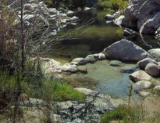
The Bureau of Land Management affect the area north of Deep Creek, north of the Forest Service Boundary. The main concern is reasonable public access to the area.
BLM route mapping
All posts are those of the individual authors and the owner
of this site does not endorse them. Content should be considered opinion
and not fact until verified independently.
| Subject | Author | Views | Posted |
|---|---|---|---|
| Katrina | 1819 | May 10, 2001 12:41PM |
Sorry, only registered users may post in this forum.


