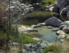
I grew up in Upland, and lived on 24st, just west of Mountain in a neighborhood just below the San Antonio Dam. So in that time back in the late 60's we did hikes up Cucamonga Canyon all the way too, and past those falls. Back then there was no graffiti and nothing but an occasional bit of trash left by a hiker. I remember on one hike we stayed overnight at those falls, and we had forgotten a can opener so we had to open our canned bacon and beans with a sharp rock :-) That concrete structure seen also had no graffiti on it. There was a cable going across the canyon by the gauging station, and if I remember correctly it went across from the top of the structure to the other side and it had a metal two seat cart on rollers that allowed in the old days a person to get across to that gauging station to check the creek level measurments. We would for fun get in it and pull ourselves across the canyon. You had to watch your fingers as you were pulling on the cable and the cart was rolling so you didn't get them cut off in the rollers :-)
In the late 70's a friend of mine and I hiked up the Ice House Canyon trail which starts just up the road from the Mt Baldy village, then we went all the way up to the high elevation saddle between Cucamonga Peak and Ontario Peak. At that point you are at the very top of the Cucamonga Canyon at its highest point and we hiked down all the way through it to the bottom. There are a couple of even taller falls up the canyon past those Saphire Falls. Also the road that goes by Saphire Falls used to go up on the back side of Frankish Peak then a long ways further all the way up to where it reconnected with the highway just below the Baldy Village. The San Antonio Creek coming down from the Baldy Village area was another one of our favorite places to go hiking. There was a falls and deep pool off a side road in that canyon just down stream from the village a ways, and also an old abandoned boy scout camp that would would sleep overnight at on what we called our Survival Hikes :-) Those last mentioned falls are probably just as ruined by graffiti as the Cucamonga ones are.
I had a favorite spot I used to visit for many years downstream from DCHS quite a ways where there is a beautiful creek pool and little waterfall, but a couple of years ago a very big piece of graffiti showed up there. It was maybe 4 foot tall and 8 foot across solidly filled in with paint. I have not gone back there since the graffiti. Just awful the degrading things people do with this graffiti. The PCT from the arch bridge all the way down to the Mojave Forks dam has graffiti the whole way and I no longer hike that section of the trail because of that.
Re: 1975
All posts are those of the individual authors and the owner
of this site does not endorse them. Content should be considered opinion
and not fact until verified independently.
| Subject | Author | Views | Posted |
|---|---|---|---|
| bobsgirl | 2587 | November 07, 2012 10:46AM | |
| katrina island | 1102 | November 10, 2012 03:05PM | |
| celtfire | 1160 | November 11, 2012 08:30AM | |
| ezzpete | 1109 | November 13, 2012 08:14PM | |
| mohave | 1104 | November 13, 2012 10:34PM | |
| ezzpete | 979 | November 15, 2012 07:42AM | |
| mohave | 911 | November 15, 2012 01:31PM | |
| calidev | 987 | November 15, 2012 05:13PM | |
| mohave | 1006 | November 15, 2012 05:43PM | |
| calidev | 1040 | November 15, 2012 06:07PM | |
| Wizard | 989 | November 15, 2012 10:37PM | |
| ezzpete | 1385 | November 24, 2012 07:26AM |
Sorry, only registered users may post in this forum.


