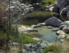
Thanks Wizard for the information regarding the parking and hiking at the Mojave Forks Dam area. After reading your directions I checked out Bing maps and used the satallite and birds eye views to see where I was and how I lost track of where the PCT trail went. Also from looking up some websites describing the PCT trail around the dam I guess when the river is running pretty high there is a detour to hike along the 173 to the Apple Valley road then head up Apple Valley a little ways until you get to a road that will gain you hiking access to the tops of some of the spill ways. By going across the tops I guess you can access the PCT trail where it goes up to the side of the canyon to the old aquaduct. The river was not that high when I was there on Saturday, I actually waded across it a few times when I was looking in the wrong place for the start of the PCT trail to the arch bridge. Now that I know how to make it from the 173 to the trail head just past the dam I think I could shave about 30 to 40 minutes off of the 3 hours it took me to go from the springs to the trail head.
I have hiked the Bradford Ridge trail a few times but I was worried that there was going to be snow up around Arrowhead and they might have the swing gate closed blocking access to the 173 to the Kerny bridge. I read somewhere that if the swing gate is closed just past Arbon Lane there is another way to access the 173 from Grass Valley road but I have not tried that route yet. Maybe some locals from up on the mountain can clarify if the Grass Valley road access to the 173 is left open when there is a little bit of snow on the ground.
I enjoyed the PCT hike into the springs, it was awesome hiking high up on the side of the hills with the river down below. I would do it again, it always seems like the first time on a new hike takes longer because I am not familiar with the trail. I am sure the next time the trail will be in better shape and I will not have to carry all the extra weight of a heavy jacket and warm clothes. Speaking of that, when it gets warmer is it okay to free hike the PCT between the dam and the springs? Most of the trail up is visible from far away so it looks like a person would have time to cover up in he needed to.
Most I my visits to the springs are just a day visit here and there, for the most part the Bowen Ranch parking works the best for me so I can maximize my soaking and relaxing time before I have to get back in the car for the 2 hour drive back home.
Re: Trip report 4/14
All posts are those of the individual authors and the owner
of this site does not endorse them. Content should be considered opinion
and not fact until verified independently.
| Subject | Author | Views | Posted |
|---|---|---|---|
| lbcalrr | 2571 | April 16, 2012 03:16AM | |
| neogeo | 1298 | April 16, 2012 09:51AM | |
| DLM | 1117 | April 16, 2012 10:21AM | |
| coyote | 1001 | April 16, 2012 03:09PM | |
| Paul P. | 1031 | April 16, 2012 03:49PM | |
| lbcalrr | 946 | April 16, 2012 06:50PM | |
| neogeo | 932 | April 16, 2012 09:30PM | |
| outlaw1 | 1002 | April 16, 2012 09:50PM | |
| Wizard | 966 | April 16, 2012 11:36PM | |
| lbcalrr | 1054 | April 17, 2012 02:45AM | |
| mdskibum | 1082 | April 17, 2012 09:17AM | |
| Wizard | 1230 | April 17, 2012 12:07PM | |
| hiker | 920 | April 17, 2012 09:45PM | |
| mdskibum | 903 | April 18, 2012 08:22AM | |
| Wizard | 1042 | April 18, 2012 09:06PM | |
| Wizard | 1513 | April 18, 2012 09:08PM | |
| Paul P. | 814 | April 17, 2012 09:47AM |
Sorry, only registered users may post in this forum.


